
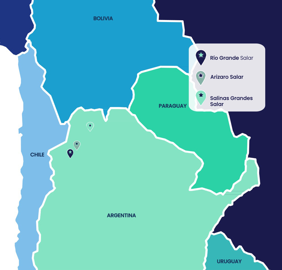
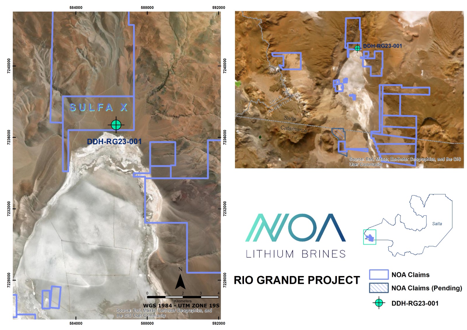
RÍO GRANDE (Flagship Project): 43,000+ ha
ARIZARO: 44,000 + ha
SALINAS GRANDES: 9,200 + ha
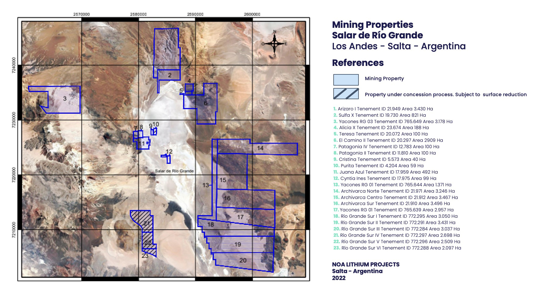
>> 43,000 ha in and around the salar; 2nd largest position after Pluspetrol
>> Next to Pluspetrol’s (formerly LSC) already explored project
>> NI 43-101 report by LSC in 2018:
>> Geoelectric studies, surface and drill holes (only up to 100 m)
>> Lithium values of more than 350 mg/l (often +450)
>> Avg. Mg/Li ratios ~5
>> Huge potential for growth in alluvial area
>> Exploration camp available
>> Good access road and nearby railway
Prospective areas at the Río Grande salar include north, central (depth), south and southeast
>> Alluvial cones (northern region)
>> Recharge area (northwestern region)
>> Evaporitic bed (central region)
>> Foothills sediments / alluvial fans (southeastern region)
The alluvial cones and foothill sediments show depth continuity of the evaporitic bed and saline phreatic levels
*Comments From LSC’s (Pluspetrol) Technical Report
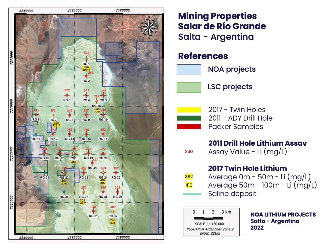
>> Several of the prospective surface and diamond drill hole samples analyzed in LSC’s report are right at NOA properties’ border limits
>> Maximum depth drilled to-date is ~100 m and most of these intercepts are +350 mg/L Li
*From LSC’s (Pluspetrol) N43-101 Report
>> Using CSAMT (conductivity), two large areas were defined that could contain deep depositional centers that are open >500 m
>> The depositional centers are more conductive = more brine potential = good Li potential
*From LSC’s (Pluspetrol) N43-101 Report
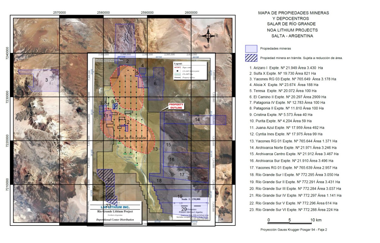
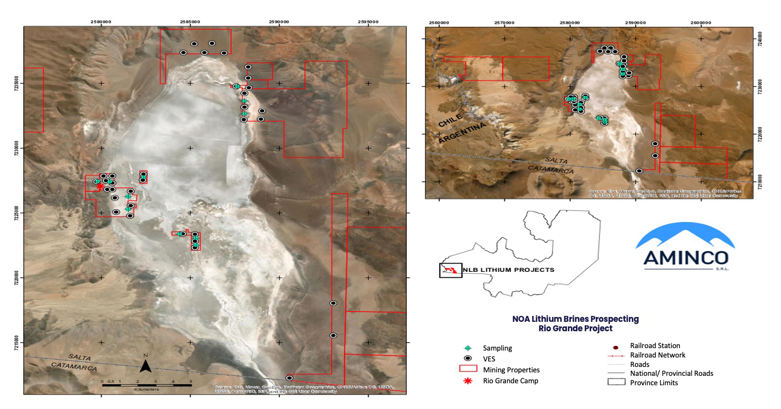
>> Surface samples with strong Li values, in-line with adjacent properties’ results (350 mg/l)
>> Brine close to the surface in the properties within the salar
>> North & northeast properties with brine potential deeper than in salar
>> Basement depth assumed to be deeper than 300 m
>> Potential water sources have been identified on NOA’s claims
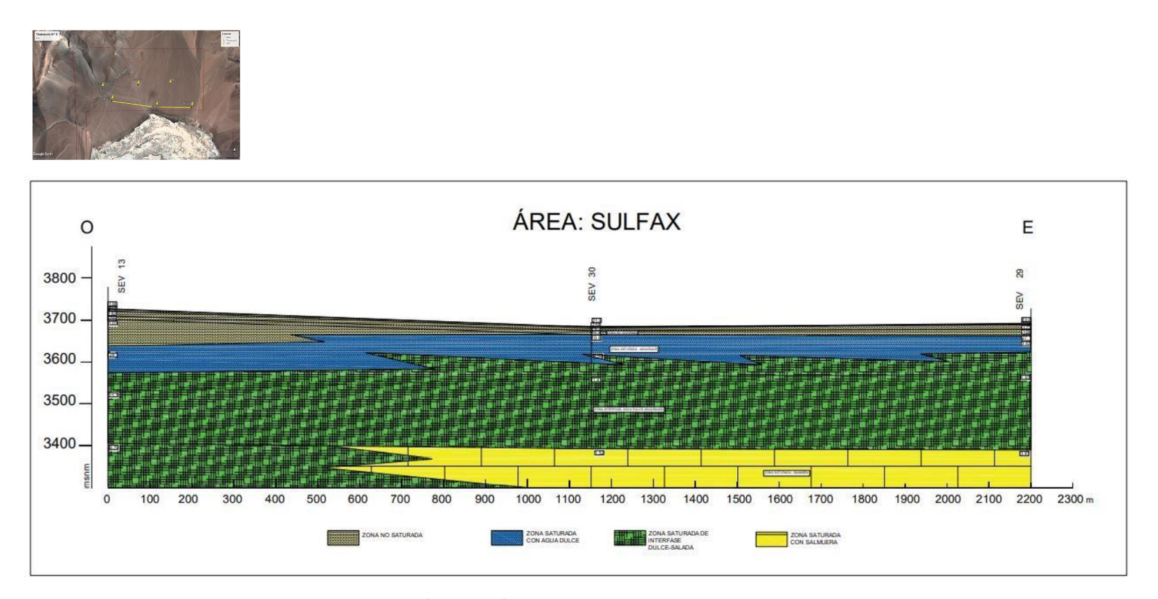
>> Potential brine-saturated zone (yellow) identified over 1.5 km at 300m depth on NOA Claim #2 (north & outside of salar)
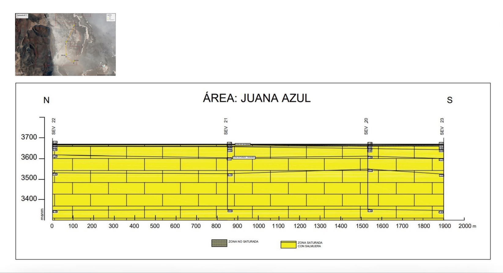
>> Entirely brine-saturated zone over 1.9 km from surface to +300m depth on NOA Claim #11 (west edge / outside of salar)
>> 6 coreholes (~500 m each) in two phases (start 1Q23)
>> Approximate locations of first three shown here
>> Determine if any additional holes needed based on results (on-going)
>> Prepare model for initial resource estimation (target 4Q23)
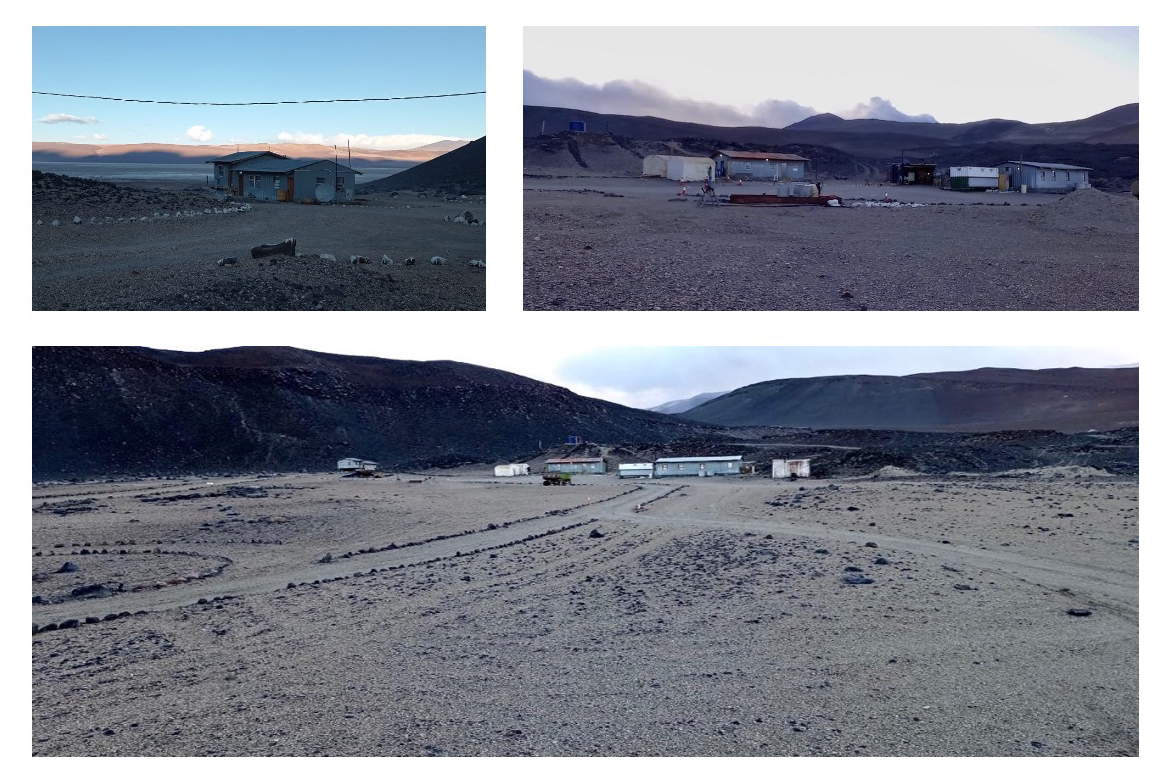
>> Ready to operate camp
>> Capacity for 50+ workers
>> Good access road
>> Fresh water on camp
>> Next to “Mariana”, “Lindero” and “Taca Taca” projects
>> One of the least explored salars in Argentina; NOA has 44,000 ha at the salar
>> Next to Lithium Chile’s already explored claims (w/ >500 mg/L Li at depth): Other companies on salar: Pluspetrol, Eramet, Tibet Summit, Hanaq
>> Close to Arizaro railway station + good road access
>> Next steps – Geophysics / sampling program followed up with initial drill program (2023)
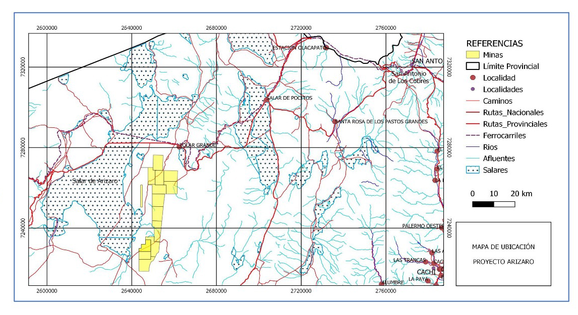
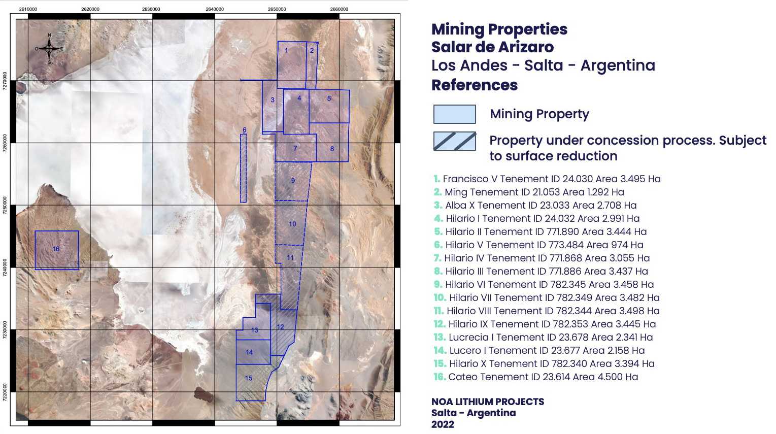
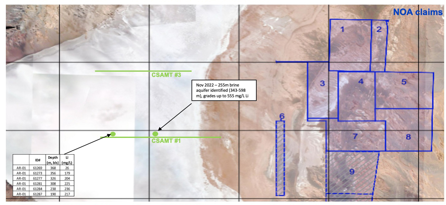
>> Lithium Chile drill results + CSAMT lines proximal to NOA indicate robust Li >300 m deep & indicate brines continue into alluvial zones east of salar
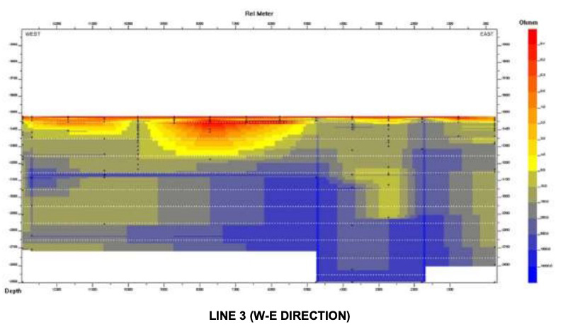
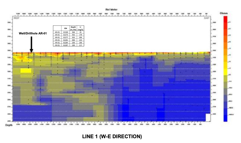
>> LITH CSAMT results, in combination with drill results, show good potential for more saline brines (lower resistivity) — proximal to NOA claims
>> 9,200 ha in the alluvial and in salar
>> Surrounded by properties already explored by Orocobre (later LSC and now Pluspetrol)
>> NI 43-101 report by LSC in 2013
>> Excellent geophysics results in TEM and VES done by NOA
>> Located by RN 40 and 25 km away from RN 52 (fully paved)
>> Only 40km away from San Antonio de los Cobres railway station
>> Close to Puna gas pipeline
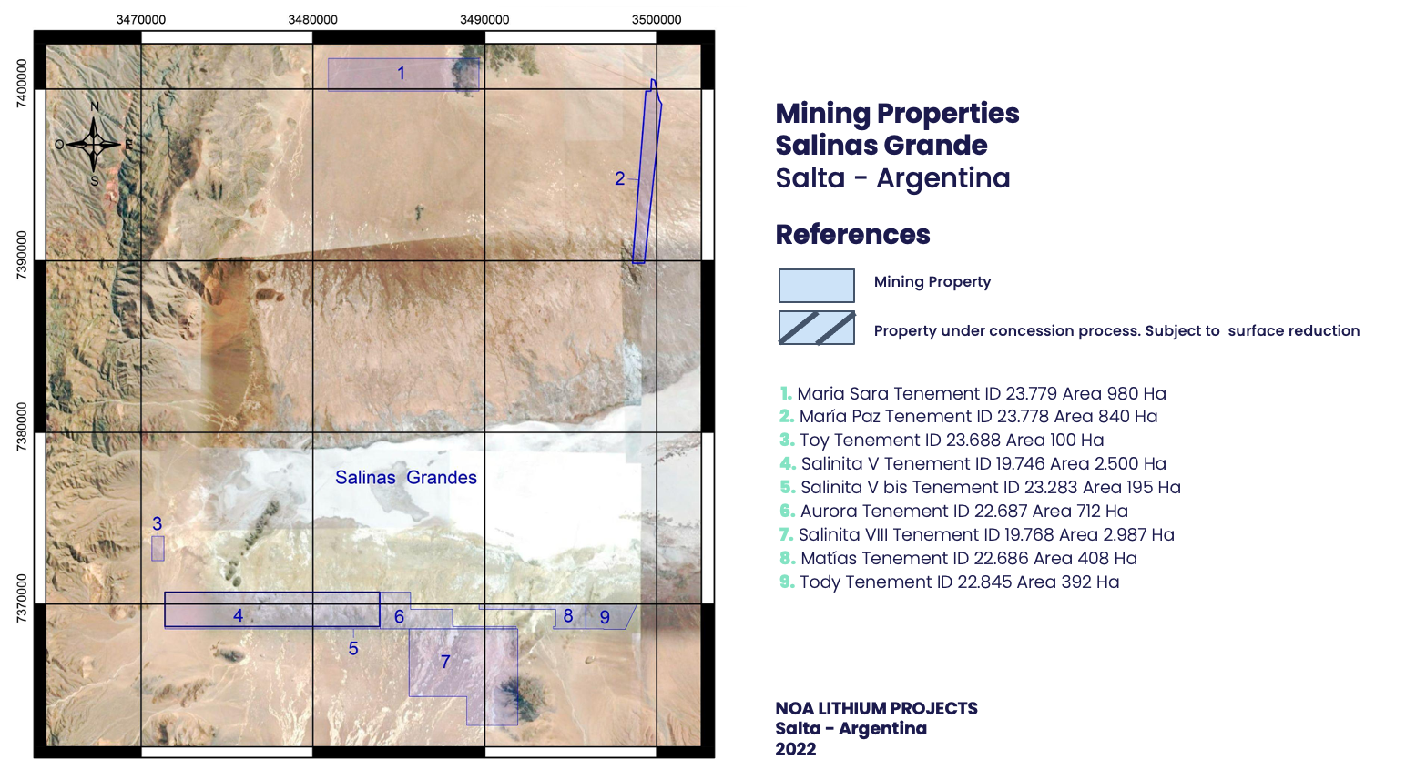
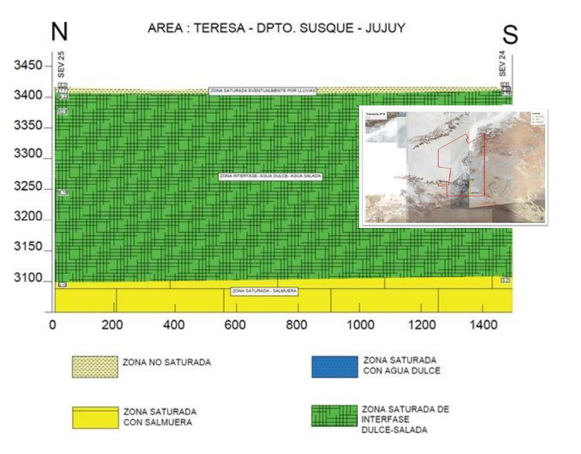
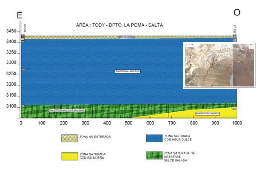
>> Brine potential (yellow) at sub-300m depth both in the salar in the alluvial